Documenting, measuring and assessing Bondi Junction urban centre through detailed public life, public space study
Bondi Junction Pedestrian and Public Life Study
Completed for Waverley City Council in 2016
About
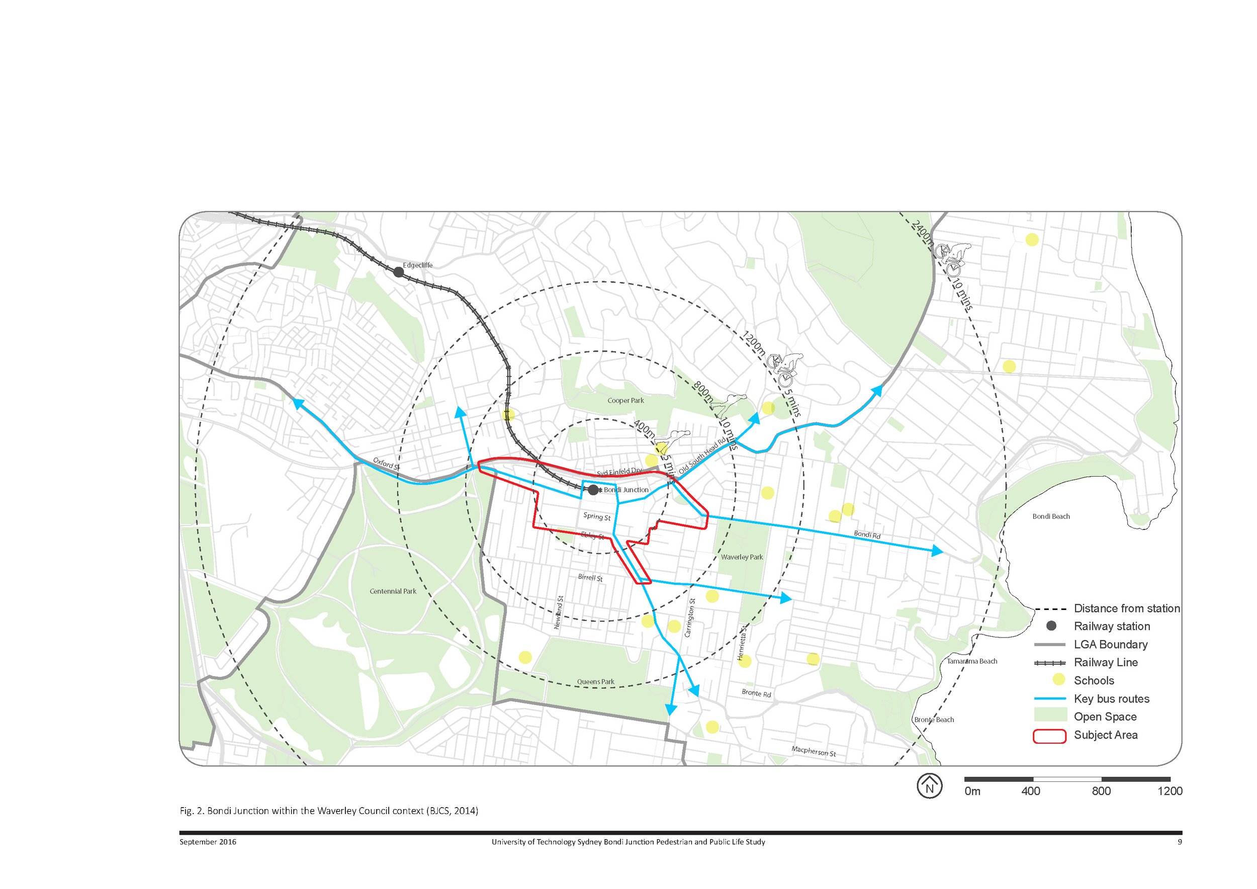
In 2015/2016 Simon undertook a Pedestrian and Public Life study of the Bondi Junction sub-regional centre for the Waverley Council, Sydney.
The project aimed to develop comprehensive data on the way that people use pedestrian thoroughfares, parks and recreational spaces in this busy eastern suburbs hub.
Simon led a team of three staff and 16 university students to conduct a series of pedestrian and space usage surveys. This series of analytical pedestrian and cyclist counts, surveys and mapping over multiple days at different locations and times aimed to take a snapshot of the public life of Bondi Junction toward the creation of creating revitalised public spaces and supporting strategies. that respond to community need.
The final report created was well received by Council and has been used to inform and prioritise streetscape upgrades and further detailed design investigations to improve the safety of pedestrians and cyclists and the overall look, feel and function of Bondi Junction. Taking a snapshot of the public life of Bondi Junction toward the creation of creating revitalised public spaces that respond to community need.
The council was particularly interested in gaining a snapshot of Bondi Junction at this moment in time, particularly from the point of view of pedestrians and cyclists, so questions of infrastructure and transport, qualities of public space that are more conducive to activation, such as seating or shade, and things like the interactions between retail or dining and the public spaces themselves are all important factors in a study of this type.
Collating the data
The study methodology was loosely based on the work of Jan Gehl, an architecture and urbanist who is known for similar urban public life studies of in Sydney, Wollongong and New York City, among others. Kilbane recruited a team of 16 UTS design landscape architecture students, who undertook the study over two days – a Thursday and a Saturday – from 6 in the morning until midnight.
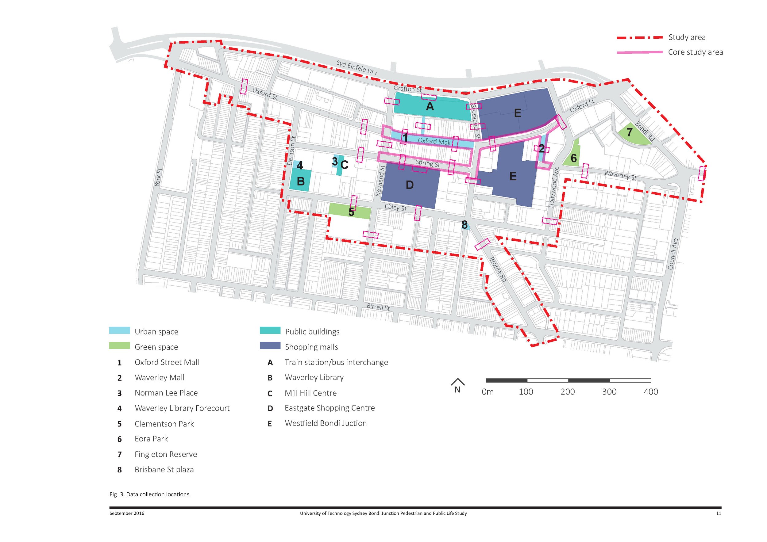
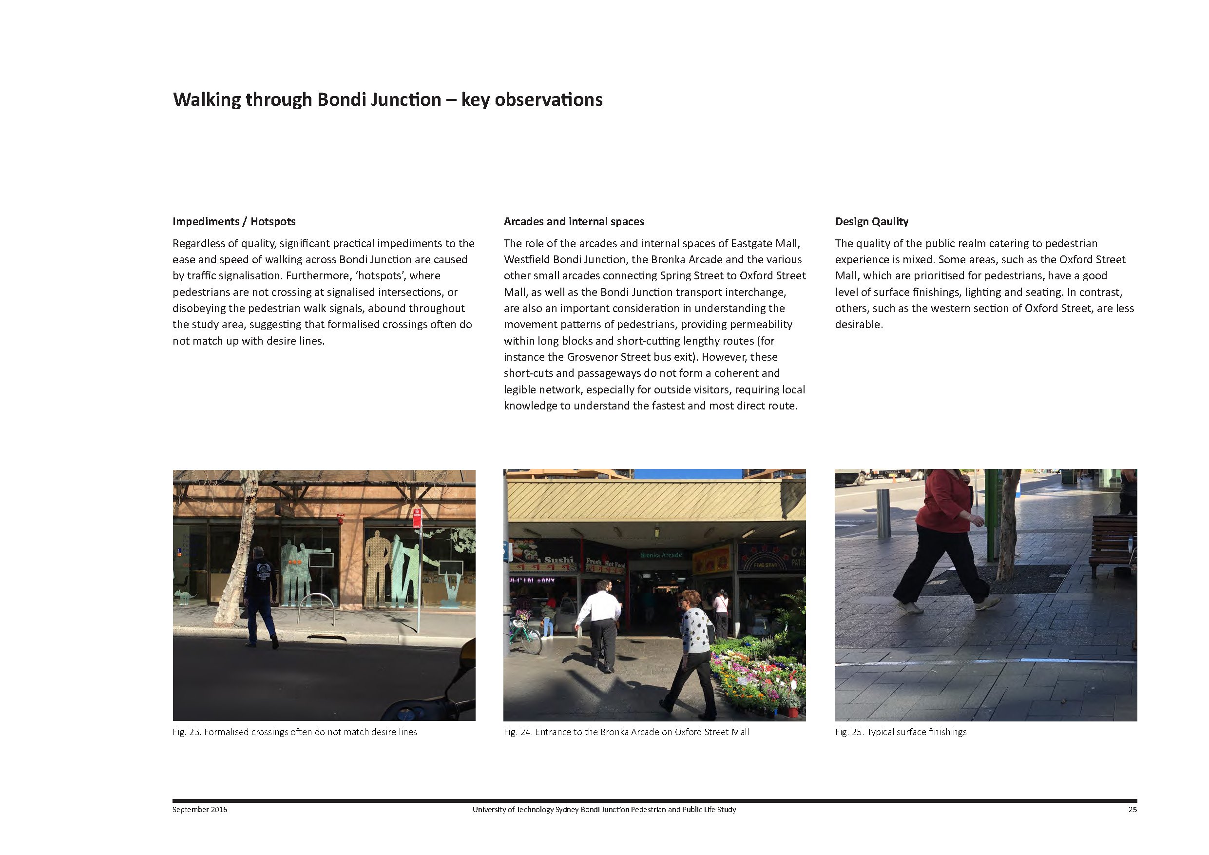
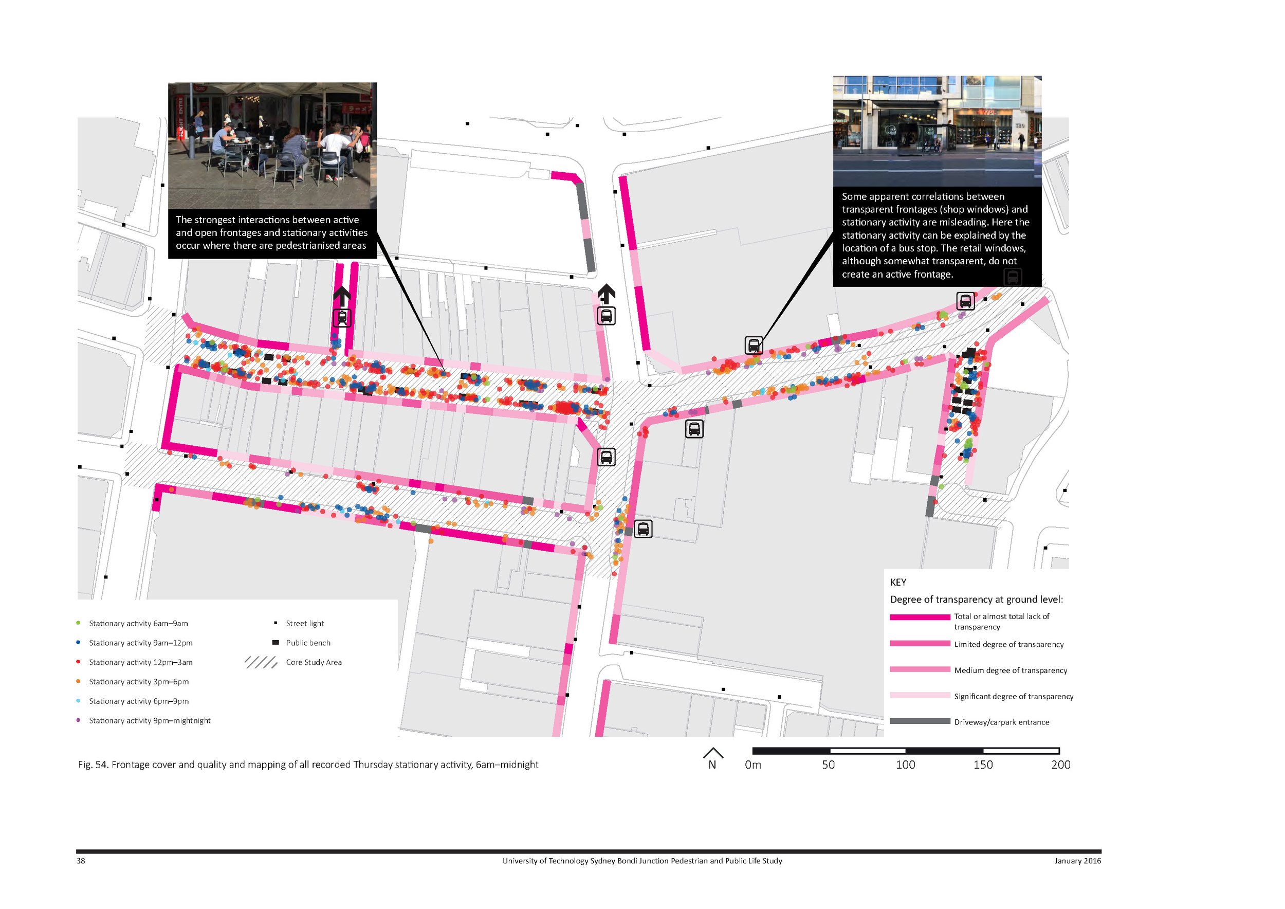
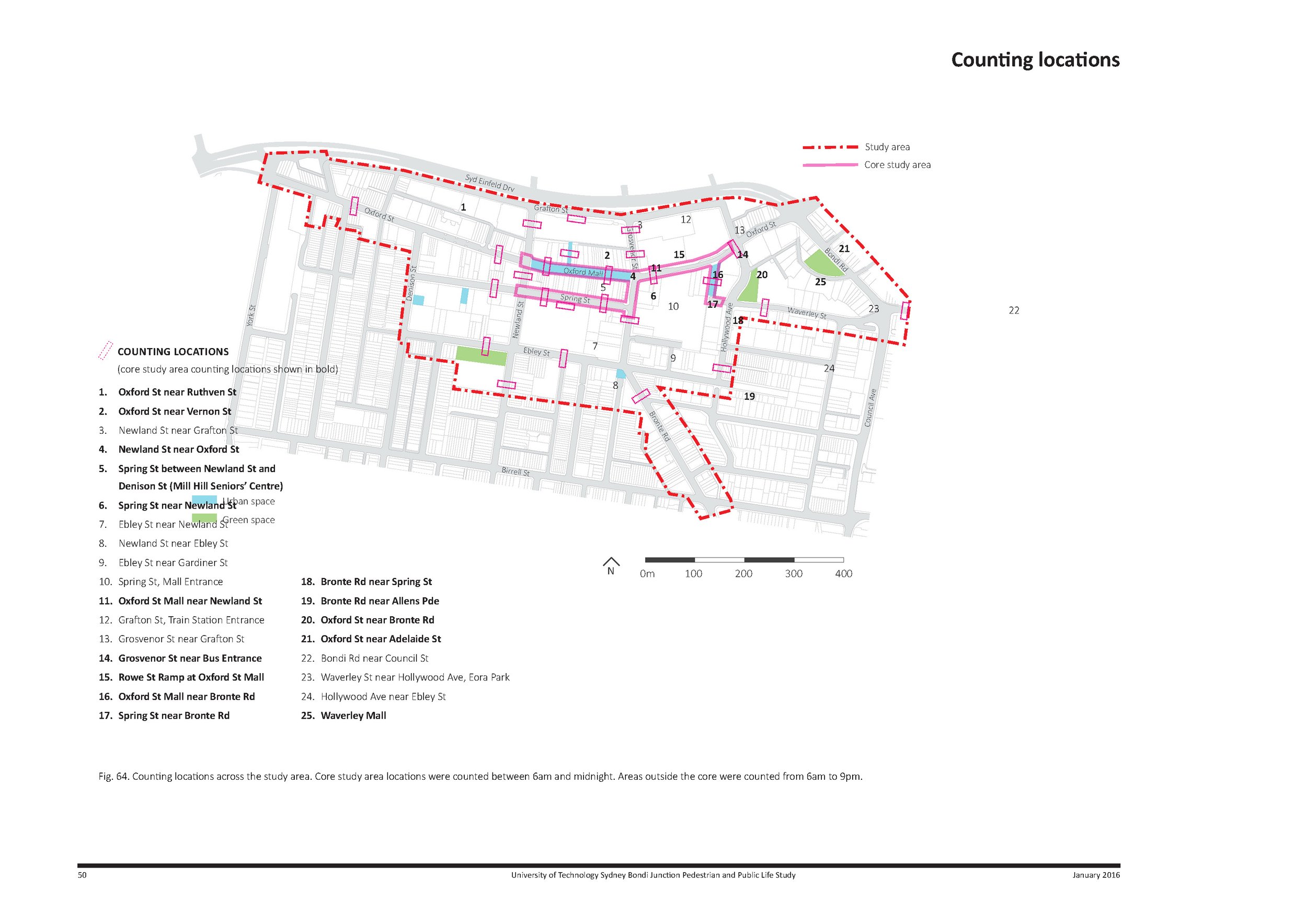
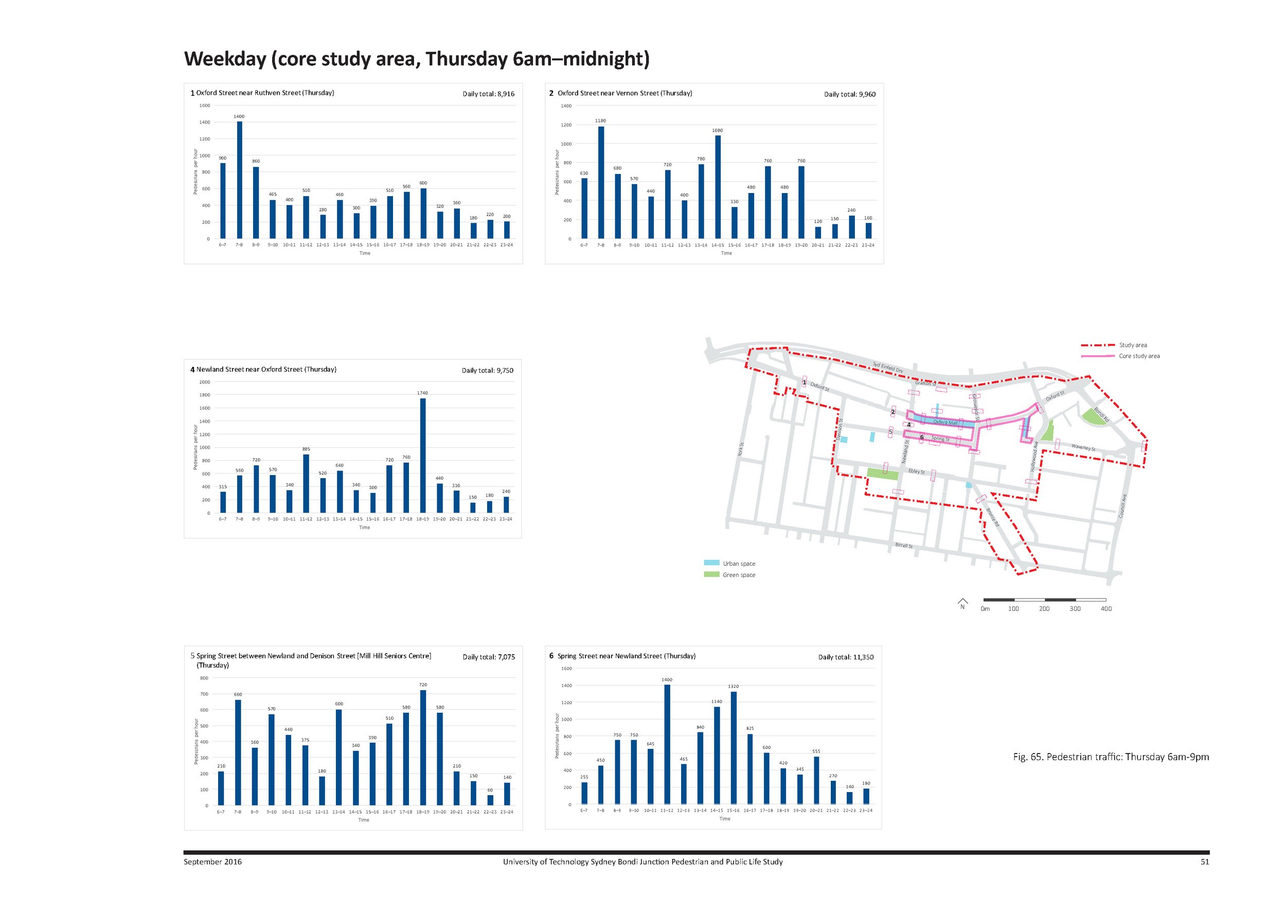
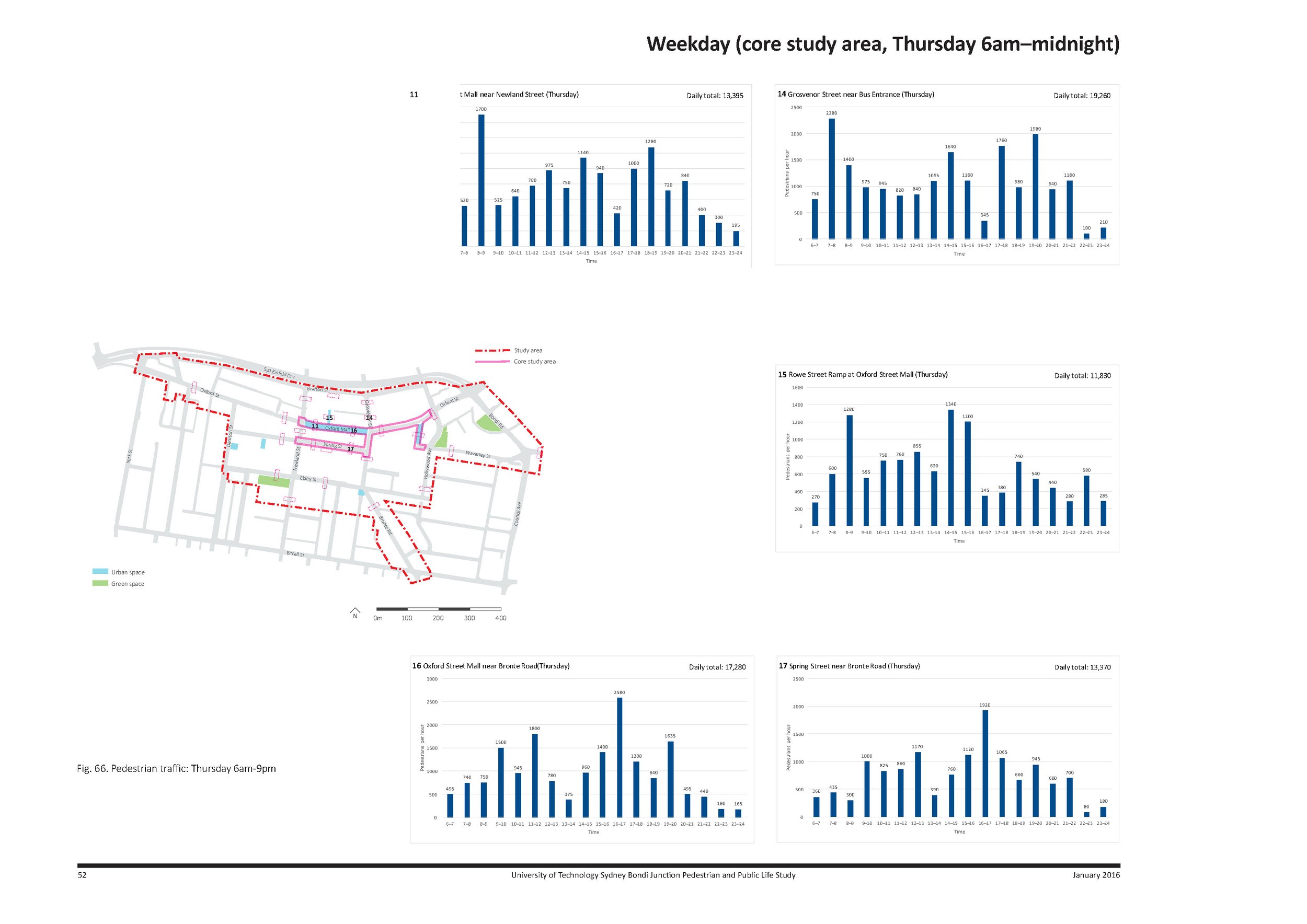
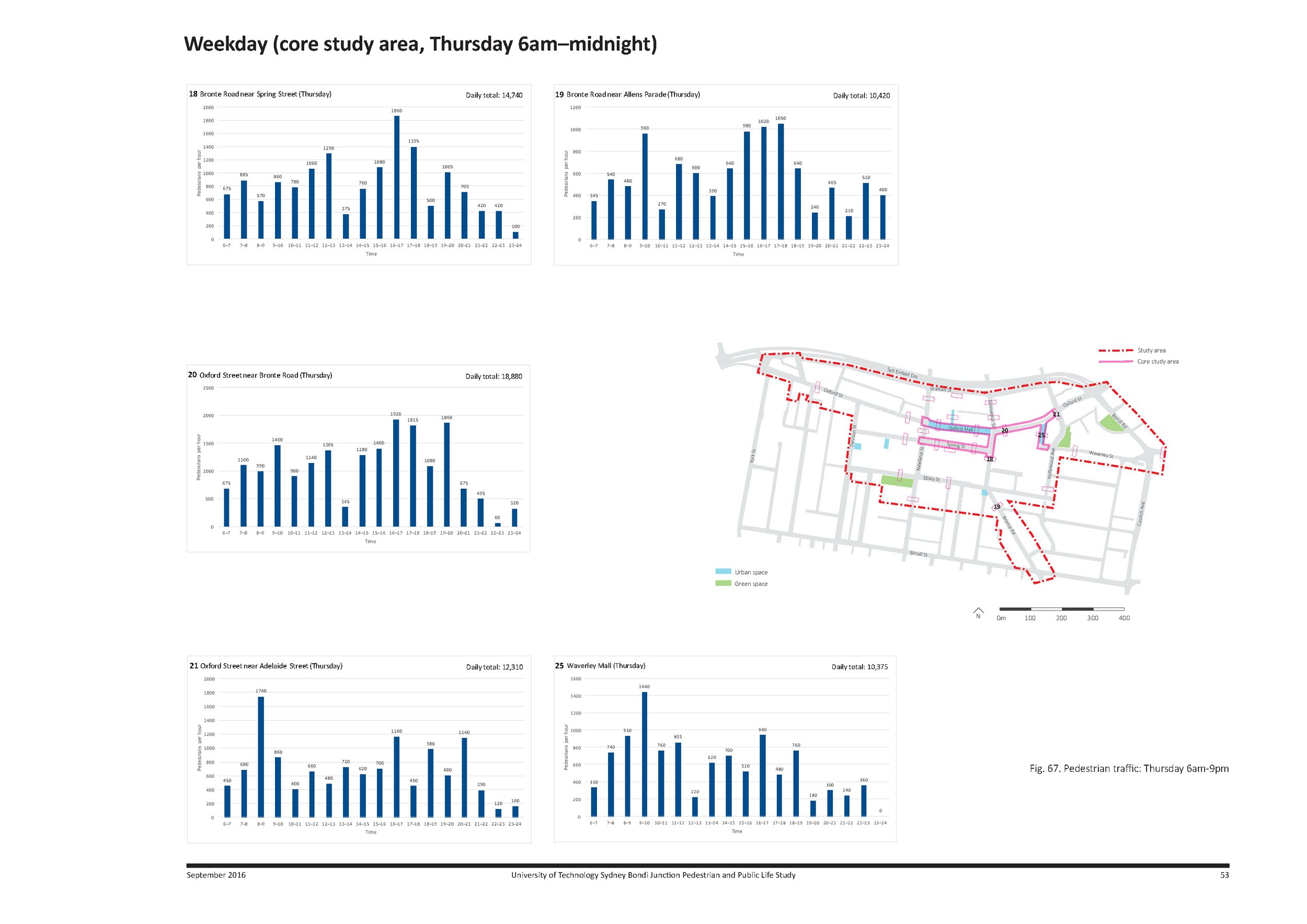
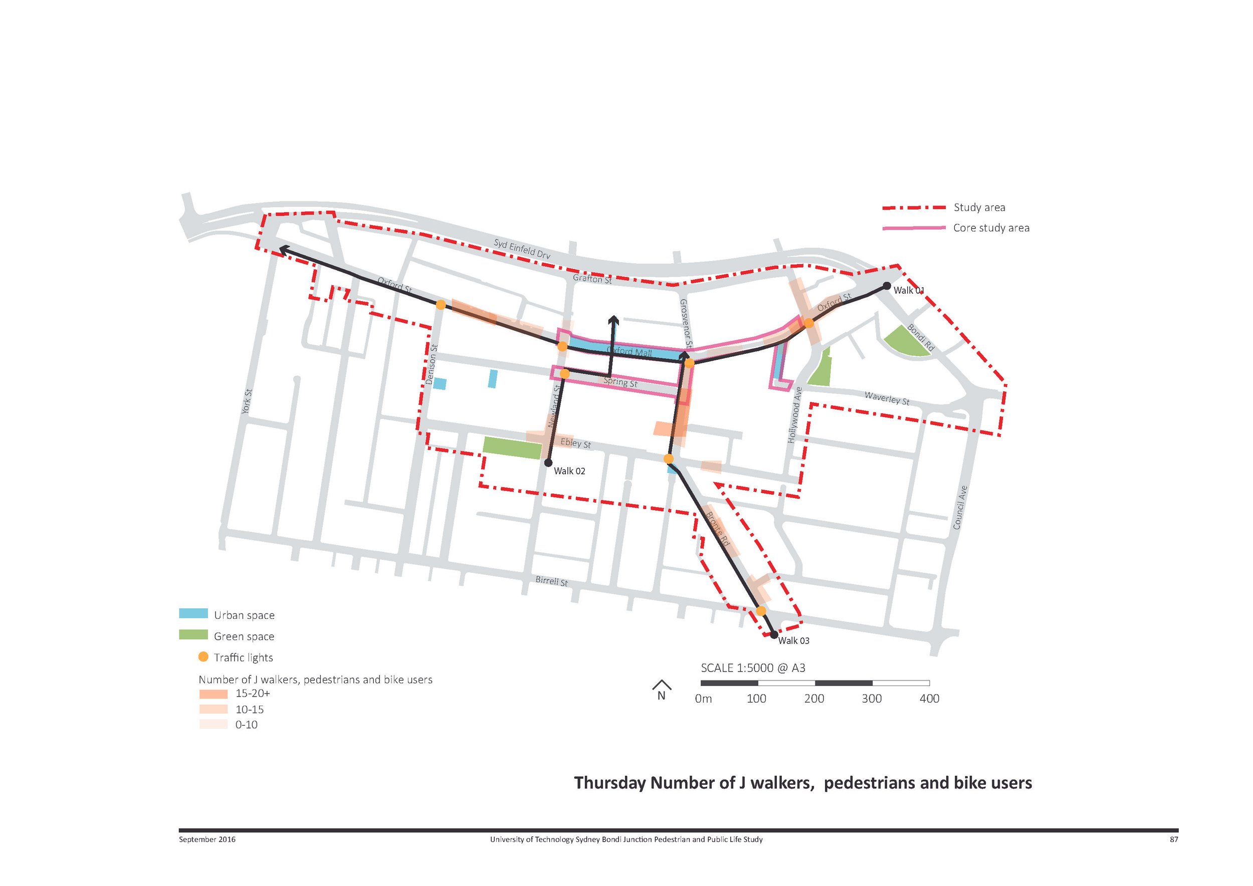
The study was split into four components: pedestrian counts that measured how many people were walking or cycling through (25) different Bondi Junction locations; stationary surveys that measured how people used the spaces when they weren’t moving through themit; test walks, in which researchers measured the time it took to walk between key points within the study zone, taking into account obstacles and traffic signals; and a frontage survey, which collated information about the quality, cover, transparency, and interface of all of Bondi Junction’s street front buildings.
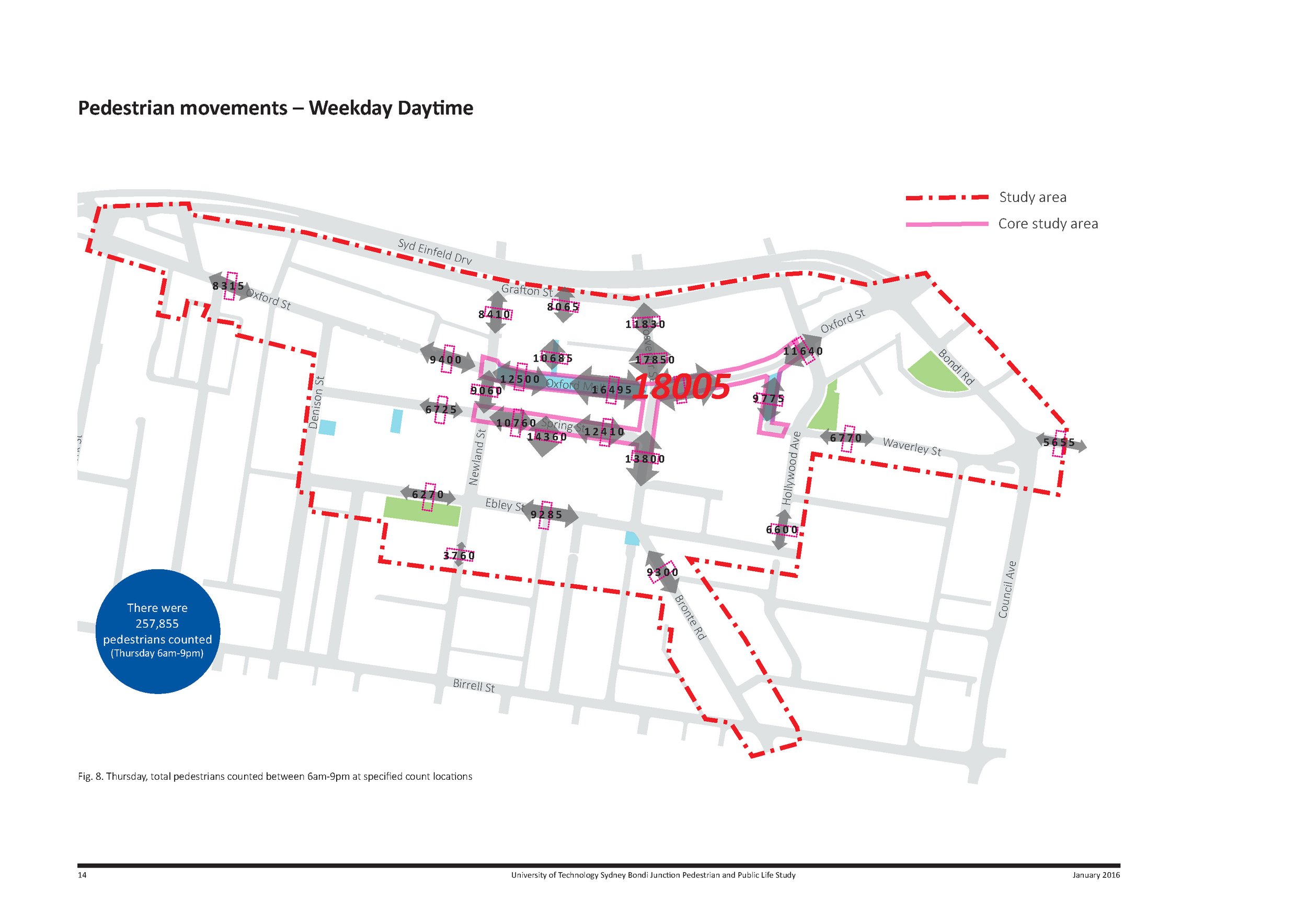
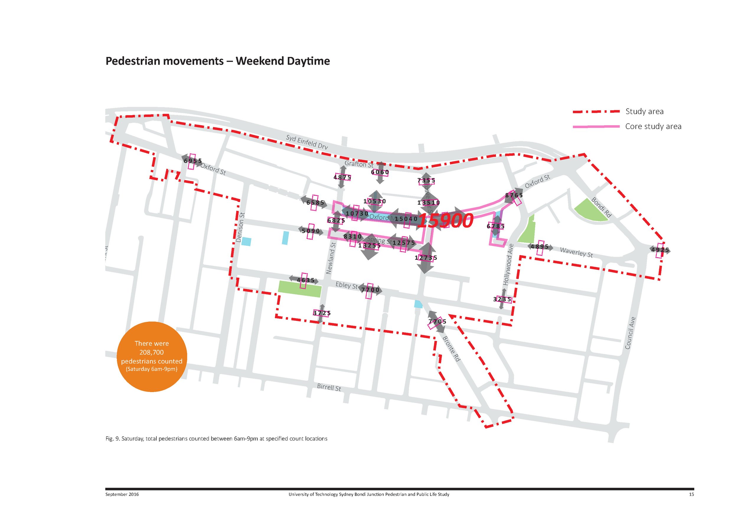
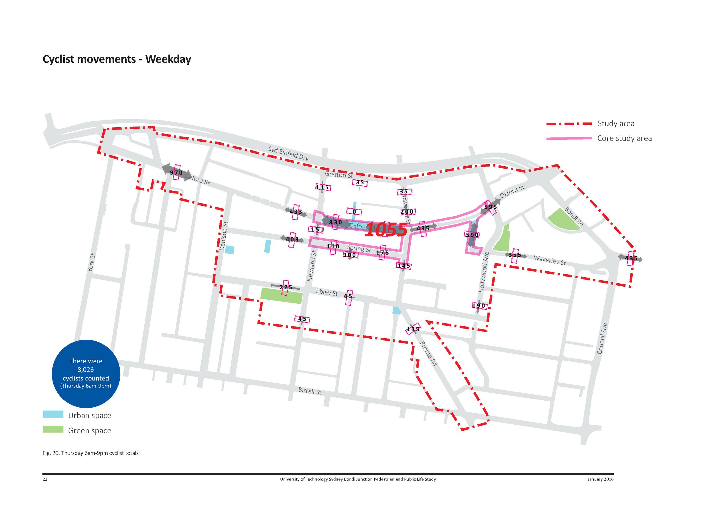
The findings were broad, but included evidence of an emerging weekend night time pedestrian trend where 9.5% more pedestrians were observed compared to the weekday, significantly higher numbers (24%) of pedestrians and cyclists on the weekday compared to the weekend, a concentration of cyclists in the Oxford St pedestrian mall, and significantly higher numbers of pedestrians on weekdays compared to weekends, which emphasised the importance of Bondi Junction as a transport hub.
A snapshot of day-to-day life
Surprisingly, the data also showed that the one place used most frequently frequented by pedestrians was not the purpose-designed Oxford Street pedestrian mall, but rather the footpath along Grosvenor Street that runs between the Westfield shopping centre and the Bondi Junction bus interchange and train station.
“This was of interest, because clearly the council has put a lot of energy and money into the creation of the mall – it’s paved and pedestrianised, activated by seating, shade sails and even a marketin a nice way, and has nice seating and shade sails and markets and so forth, whereas Grosvenor Street doesn’t appear to have been a focal point,” Kilbane says.
The research findings provide an evidence base for a series of council upgrades and strategic changes, including better cycling infrastructure, streetscape improvements and new green spaces.
Key skills
- Site visits and survey design
- Data collection through surveying, mapping and monitoring of urban street life
- Illustration and visualisation of findings and statistics
- Final illustrated report collated to reflect relevant policy and planning settings
Other team
- Andrew Toland, Kane Pham and Josephine Neldner (UTS)
- 14 x undergraduate Bachelor of Landscape Architecture students (UTS)
Link to report
